
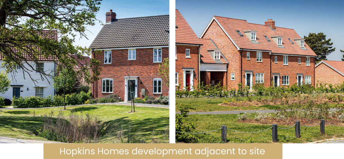
Hopkins Homes is consulting the community on plans for a landscape led development of approximately 260 new homes for the local community on land east of Ringsfield Road, Beccles. The proposals include bungalows, one and twobedroom homes and a variety of larger family homes. The scheme looks to address housing need locally and provide affordable homes.
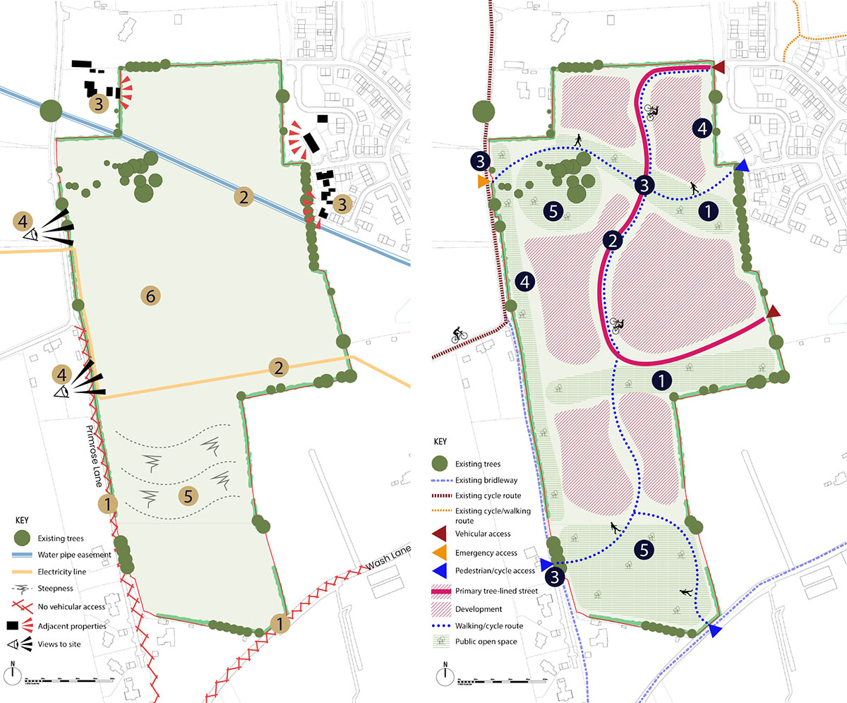
The proposals include public open space, play areas and new walking and cycle routes that will connect into the surrounding cycle network. Vehicle access into the scheme will be from London Road via Butterfly Drive, connecting with the adjacent new development of Barsham Vale.
The proposed development is being broughtforward to help address unmet market andaffordable housing needs in a high quality green setting. The site is a deliverable housing site at the edge of one of the most sustainable settlements in the former Waveney District area.
The housing requirement for East Suffolk, including Waveney, has almost doubled from that planned for in the adopted Waveney Local Plan.
The adopted Local Plan makes provision for 374 dwellings per annum. The required housing figure, as calculated in accordance with the government’s new standard method has risen to 723 dwellings per annum.
Against the current requirement the Council is unable to identify a sufficient number of deliverable housing sites to achieve the minimum five years worth of supply required by national policy. The Council’s latest published position (December 2025) indicates a supply of 3.23 years or a shortfall against the minimum requirement of -1,341 homes.
East Suffolk Council have begun to produce a new Local Plan, but this is not projected to be adopted until 2029.
In the meantime, as acknowledged in the Council’s housing action plan, more, well located, sustainable sites, not included in the current Local Plan will need to be considered positively in order to seek to address this shortfall.
Hopkins Homes have been engaging with EastSuffolk Council, Beccles Town Council and through this public consultation on their proposals to explore how the site can best help to meet these needs in a positive manner for the local and wider area.
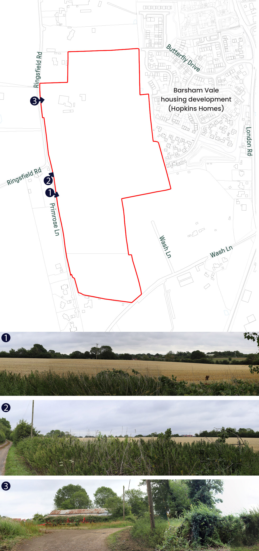
The site is suitably connected to the surrounding area and will be primarily accessed via the adjoining Barsham Vale residentialdevelopment at Butterfly Drive.
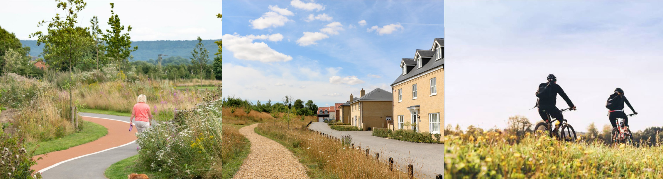
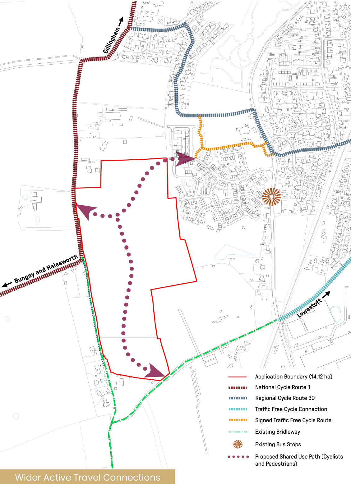
The site benefits from strong connections to the National Cycle Network and nearby Public Rights of Way (PRoW). The proposals will provide convenient walking and cycling links to local services, open spaces and surrounding routes, helping to actively encourage sustainable modes of transport.
The site provides an opportunity to create a safe, legible, and attractive cycling link between Cycle Route 1 to the west and Cycle Route 30 to the east.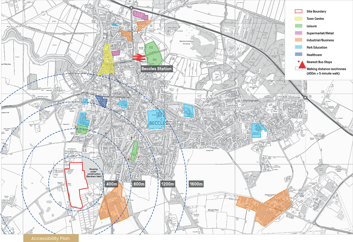
The site has access to nearby public transport, offering links to wider destinations and supporting sustainable travel patterns.
By integrating with existing routes and prioritising movement by foot and cycle, the proposals will form a connected extension to the neighbouring development, while also improving accessibility to the wider area.
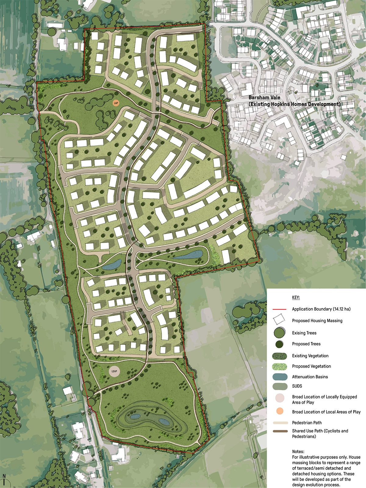
The illustration indicates a high level layout for the development, with approximately 260 new homes of varied types and sizes to meet local needs, including bungalows, two-bedroom homes, and larger family housing, with 30% affordable provision.
A landscape-led layout that responds sensitively to the surrounding context and natural topography.
Homes arranged in small “village” clusters with homezones and traffic-calming measures to create people-focused streets.
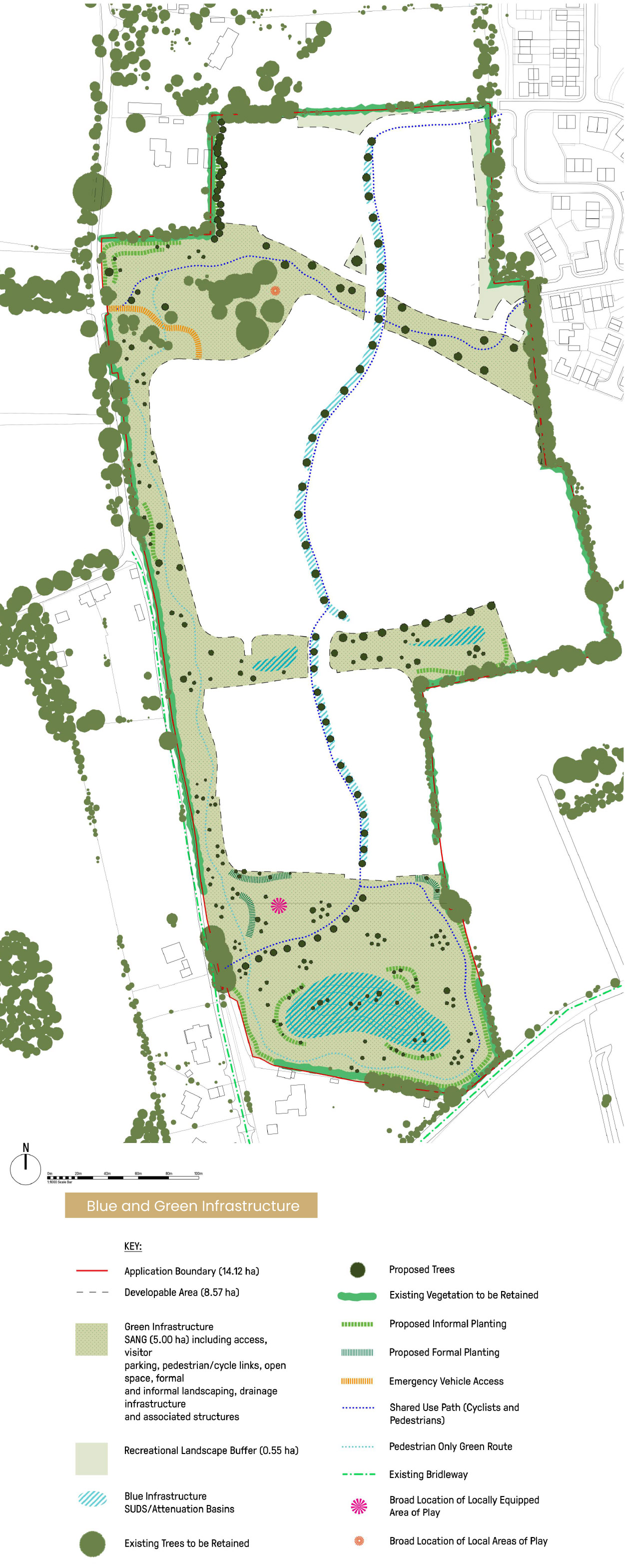
Attenuation ponds (SuDS) to the south will manage surface water, reduce flood risk, and enhance landscape and biodiversity.
A linear park along the western edge will provide a strong green buffer and screen the development from the wider landscape.
New pedestrian and cycle links will connect the site to the wider active travel network.
Retention and enhancement of existing vegetation and creation of green corridors to strengthen biodiversity and site character.
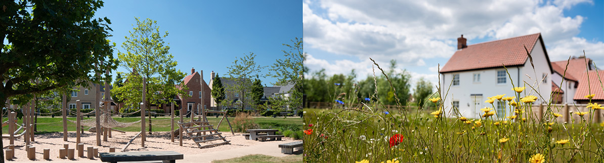
High-quality open spaces, including informal recreation and play areas, for community use.
Sustainable design principles embedded throughout the development, supporting a low-impact, energy-efficient neighbourhood.
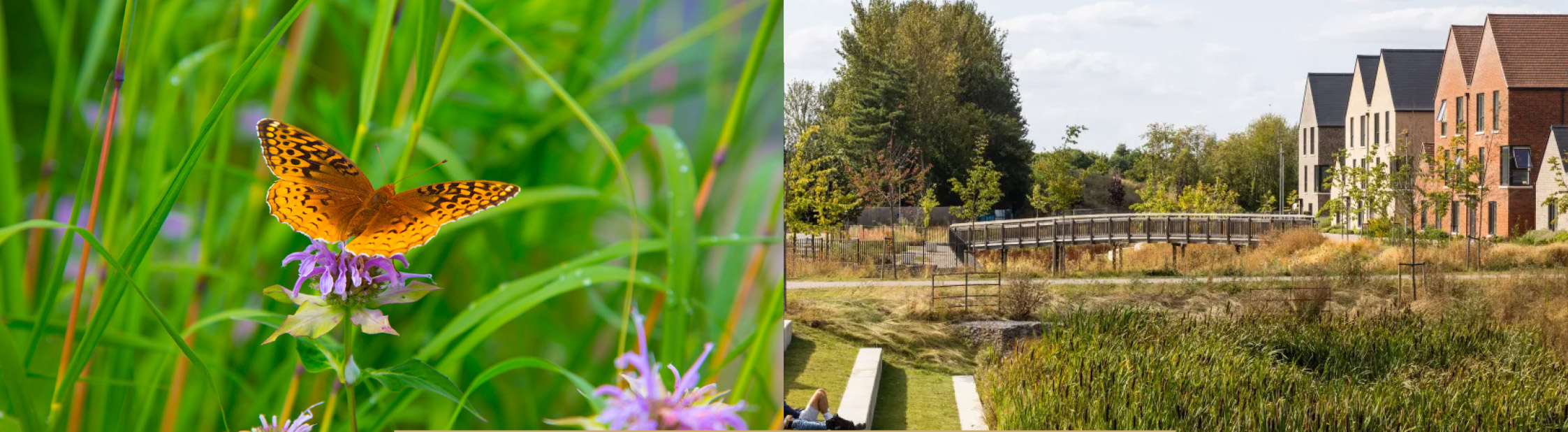
Network of green and blue infrastructure corridors creating valuable community open spaces.
Responds to the surrounding landscape setting.
Green spaces easily accessible.
A variety of open spaces.
Inclusive spaces for relaxation, social interaction, and community activities.
Visually appealing street landscaping.
Landscape proposals complement surrounding built form and character.
Cohesive and consistent streetscape.
Biodiversity enhancements through natural habitats and wildlife corridors.
Native scrub and tree planting to soften visual impact.
Long-term landscape framework strengthening over 15+ years.
All habitats of note (woodland, hedgerows, trees, and adjacent pond) will be retained and enhanced with wildlife friendly native planting, including berry-bearing species to provide foraging resources for wildlife.
Habitats include wildflower grassland, new trees and hedgerows, and SuDS with flowering wetland species.
Bat and bird boxes integrated into the new buildings, as well as log piles to provide refuge for invertebrates, reptiles, and hedgehogs.
Sustainable Drainage and Water Features Water-responsive design integrated as a visible and functional landscape feature.
Sustainable drainage (SuDS) integrated to manage surface water naturally.
Water-responsive design integrated as a visible and functional landscape feature.
Sustainable drainage (SuDS) integrated to manage surface water naturally.
SuDS and landscape design creating attractive, ecologically rich public spaces.
Infrastructure contributions are secured in two ways in East Suffolk, via the Community Infrastructure Levy (CIL) and through S106 planning obligations. CIL is a fixed rate charge used to fund infrastructure needed to support new housing. S106 planning obligations are more directed, site-specific measures needed to meet policy requirements and mitigate the impacts of the development. The CIL and S106 measures required from the development will be finalised through the application process. A summary of what could be secured is summarised below:
• Affordable homes
• Accessible and adaptable homes
• Self build/custom build homes
• Transport improvements
• Travel Plan
• Public Open Space and its future management • Suitable Alternative Natural Green Space (SANG)
• Suffolk Coast Recreational Disturbance Avoidance and Mitigation Strategy (RAMS) payment, at the prevailing rate per dwelling
• Biodiversity Net Gain (BNG)
• SUDS management
Please send your comments by email to info@arplanning.co.uk or in writing to the address below:
ARMSTRONG RIGG PLANNING
THE EXCHANGE
COLWORTH SCIENCE PARK
SHARNBROOK
BEDFORD
MK44 1LZ
